|
|
|
NEW: Amazon Forest and Savanna Lands
A guide to the climates, vegetation, landscapes, and soils of central tropical South America Irrigation book for Santa Cruz:
Contact Information:
FAX (New Zealand): +64 3 364 2758
|
Climatic data is available for the Amazon region and south America from
various government agencies, institutions, and organizations. We present
here some of the data we have been able to compile and organize for Bolivia,
Peru, Brasil and Paraguay. Please acknowledge usage of data and if you
come across other sources of climatic or hydrological data please send us the
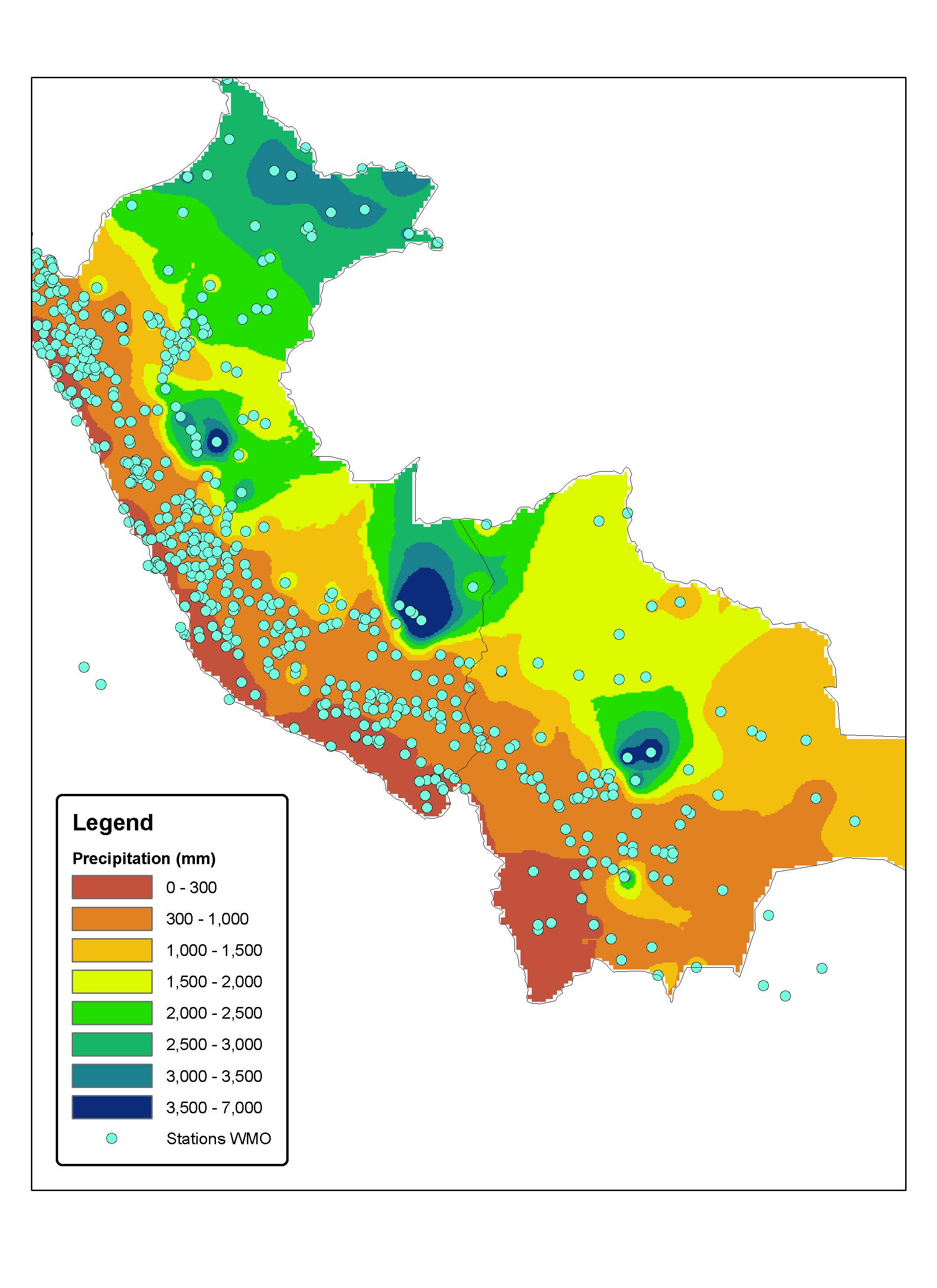
links or data ( Historical data from the WMO (World Meteorological Organization / NOAA). This data has been compiled from published data that was available in the internet at one time at the following address: http://lwf.ncdc.noaa.gov/oa/pub/data/ghcn/v2/ghcnftp_zipd.html - contains precipitation and temperature data from around the world. The data consists of historical precipitation data for a variety of stations as shown in the first picture (a) . The second picture (b) shows an interpolation of historical precipitation in Bolivia and Peru: (a)
Compiled data for Brasil:
Compiled data for Bolivia/Peru/Paraguay:
Temperature data is also available and we will put it online as soon as we compile it. Climate data for the Amazon from Land in Tropical America
Data for Bolivia: Various sources of data have been found and compiled for Bolivia. Most data in Bolivia is maintained (collected) by SENAMHI (which charges for data -- about 10bs per data point) and AASANA. Historical data (precipitation and temperature) has been collected by the WMO from these agencies and is included in the data presented previously. Creation of isotherm and isohyets maps to denote historical annual temperature and precipitation has been done by FAO in the early 1990's (see pictures below).
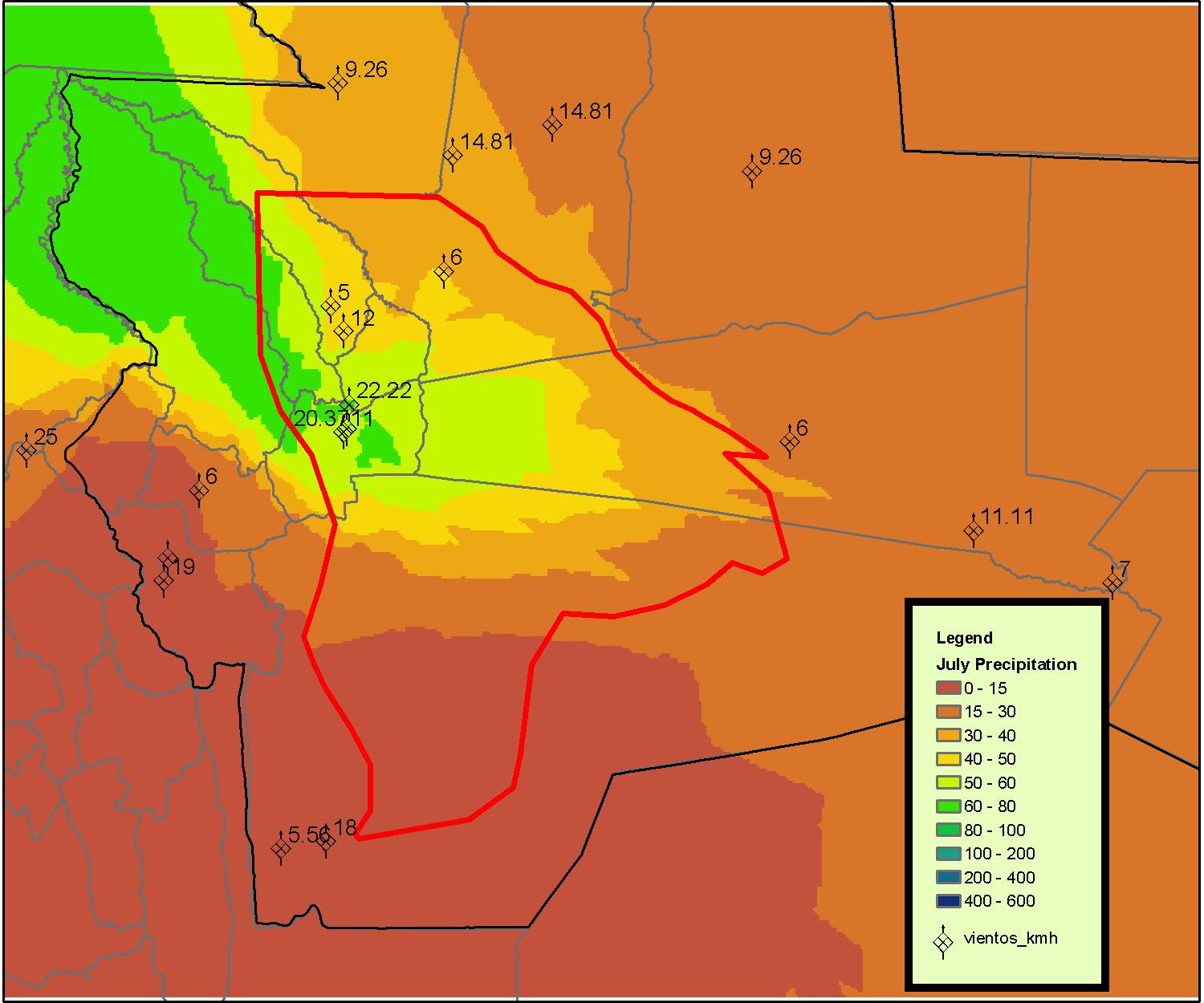
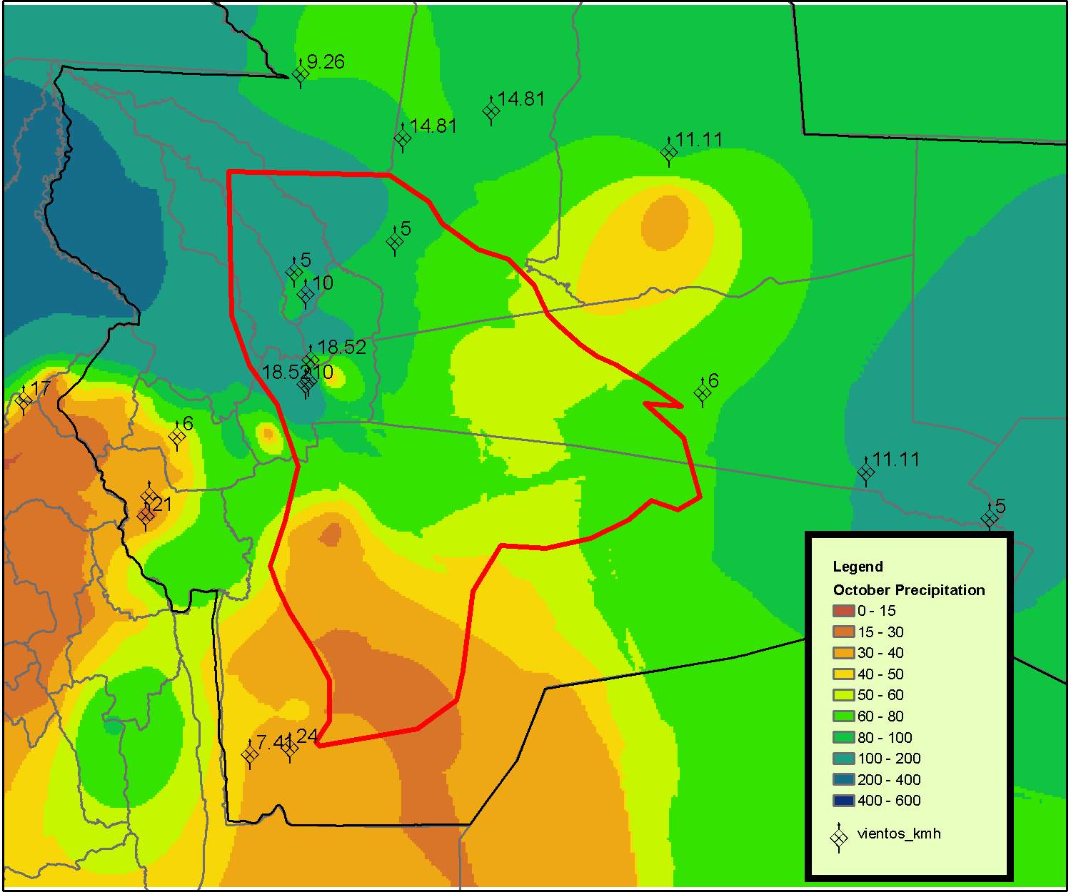
Data for the Departamento de Santa Cruz: The data presented below has been digitized and compiled from the Compendio Meteorologico del Departamento de Santa Cruz 1992. Estimations of evapotranspiration and historical trends have been created using this data. Map (a) shows historical precipitation (b) precipitation in January (c) April (d) July and (e) October of the Departamento de Santa Cruz. (a)
Other data from Brasil: The ANA (Agencia Nacional de Aguas) in Brasil maintains an active database of climatic and river data for stations in Brasil. Although its a little cumbersome to use, there is a wealth of data here: http://hidroweb.ana.gov.br/HidroWeb/
|
|
Last modified: July 23, 2010 |